AIRPORT INFORMATION
|
FAA
Identifier:
|
O52
|
|
Lat/Long:
|
39-07-25.2000N / 121-36-19.3000W
39-07.420000N / 121-36.321667W
39.1236667 / -121.6053611
(estimated)
|
|
Elevation:
|
59.6 ft. / 18 m (estimated)
|
|
Variation:
|
16E (1985)
|
|
From
city:
|
1 mile S of YUBA CITY, CA
|
|
Time
zone:
|
UTC -7 (UTC -8 during Standard
Time)
|
|
Zip
code:
|
95991
|
Airport
Communications
|
CTAF/UNICOM:
|
122.7
|
|
WX ASOS at MYV (2.3 nm SE):
|
118.475 (530-742-0695)
|
|
WX AWOS-3 at LHM (17 nm SE):
|
124.25 (916-645-0698)
|
Airport
Operations
|
Airport
use:
|
Open to the public
|
|
Activation
date:
|
08/1947
|
|
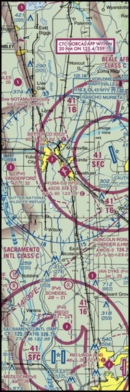
Sectional
chart:
|
SAN
FRANCISCO
|
|
Control
tower:
|
no
|
|
ARTCC:
|
OAKLAND CENTER
|
|
FSS:
|
RANCHO MURIETA FLIGHT SERVICE
STATION
|
|
NOTAMs
facility:
|
RIU (NOTAM-D service available)
|
|
Attendance:
|
MON-FRI 0800-1700
|
|
Pattern
altitude:
|
1059.6 ft. MSL
TURBINE-POWERED ACFT OR LARGE ACFT SHALL ENTER THE TRAFFIC PATTERN AT 1500'
AGL.
|
|
Wind
indicator:
|
lighted
|
|
Segmented
circle:
|
yes
|
|
Lights:
|
ACTVT MIRL RY 17/35 & VASI RY
17- CTAF.
|
|
Beacon:
|
white-green (lighted land airport)
Operates sunset to sunrise.
|
|
Taxiway
lights:
|
TWY REFLECTORS; LGTD EXIT ARROWS.
|
Nearby
radio navigation aids
|
VOR radial/distance
|
|
VOR
name
|
|
Freq
|
|
Var
|
|
MYVr299/2.1
|
|
MARYSVILLE
VOR/DME
|
|
110.80
|
|
16E
|
|
ILAr063/19.9
|
|
WILLIAMS
VORTAC
|
|
114.40
|
|
18E
|
|
MCCr324/28.9
|
|
MC
CLELLAN VOR/DME
|
|
109.20
|
|
17E
|
|
MXWr094/30.9
|
|
MAXWELL
VORTAC
|
|
110.00
|
|
18E |